
Garmin eTrex 22x Review: Rugged, No-Nonsense Handheld GPS for Serious Navigation
This review examines the **Garmin 010-02256-00 eTrex 22x, Rugged Handheld GPS Navigator, Black/Navy**, a compact, button-driven handheld GPS designed for hiking, biking, boating, and general outdoor navigation. Key points include its rugged IPX7-rated build, 2.2-inch sunlight-readable color display, preloaded TopoActive maps with routable roads and trails, support for GPS and GLONASS satellite systems, generous internal storage with microSD expansion, and long battery life. The article breaks down typical use cases, evaluates performance in each scenario, and highlights the device’s strengths and limitations to help users decide if this unit is the right fit for their navigation needs.
Introduction
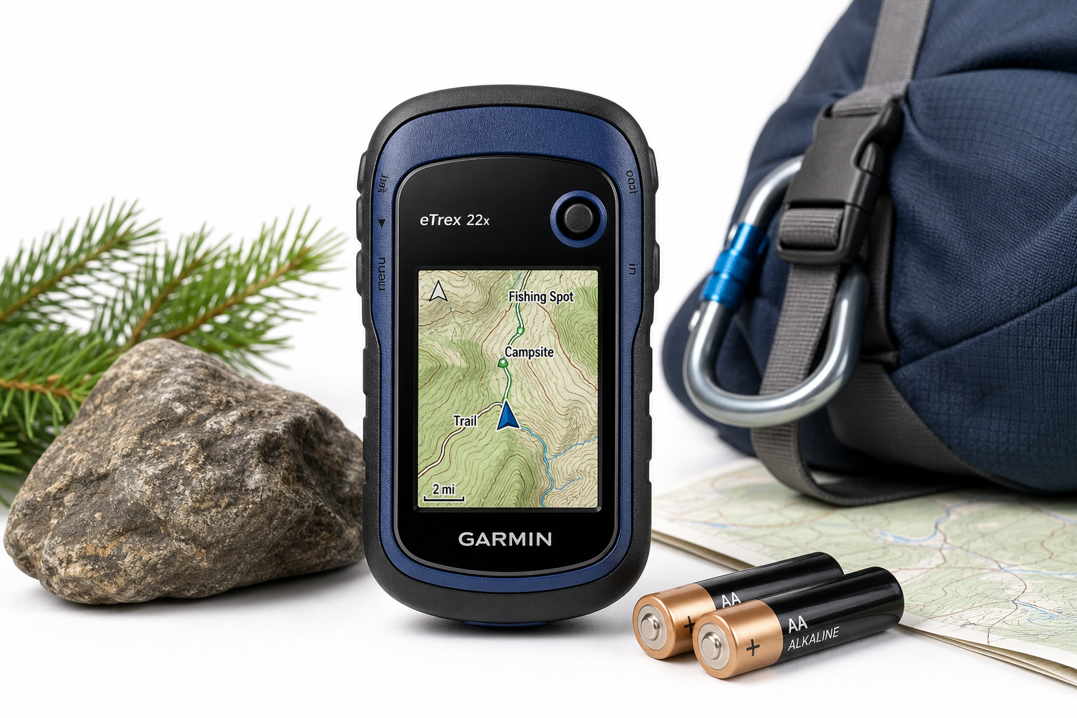
The Garmin 010-02256-00 eTrex 22x, Rugged Handheld GPS Navigator, Black/Navy is a compact, durable handheld GPS aimed at outdoor users who want reliable, purpose-built navigation without relying on a smartphone. Part of Garmin’s long-running eTrex line, the 22x continues the series’ focus on simplicity, toughness, and long battery life.
Key characteristics include a 2.2-inch sunlight-readable color display, support for both GPS and GLONASS satellite systems, IPX7 water resistance, and preloaded Garmin TopoActive maps with routable roads and trails. The device offers 8 GB of internal storage plus a microSD card slot for additional maps, and it runs on two standard AA batteries.
Rather than trying to be a do-everything smart device, the eTrex 22x focuses on one thing—getting you from point A to point B in challenging environments—with dependable hardware and a traditional button-based interface.
Typical Use Cases
1. Hiking and Backpacking
The Garmin eTrex 22x is a natural fit for day hikes and multi-day backpacking trips where durability and long battery life are more important than a large touchscreen.
Typical hiking tasks include:
- Following preplanned routes or tracks
- Marking waypoints such as campsites, trail junctions, and water sources
- Checking distance, elevation gain, and estimated time to destination
- Navigating in forests, canyons, and mountainous terrain where satellite reception can be challenging
2. Cycling and Bikepacking
Mounted on handlebars or carried in a pack, the eTrex 22x supports cycling navigation via its routable TopoActive maps. It suits riders who prioritize reliability and weather resistance over advanced training metrics.
Typical cycling uses:
- Navigating unfamiliar backroads and gravel routes
- Following GPX tracks for bikepacking tours
- Keeping an eye on speed, distance, and trip data via the trip computer
3. Boating and Kayaking
The rugged, water-resistant construction and AA-battery power make the eTrex 22x a practical backup or primary navigation tool for small boats, kayaks, and canoes.
Common boating scenarios:
- Marking put-in and take-out locations
- Logging fishing spots or points of interest along a shoreline
- Tracking drift and heading over longer crossings
4. Off-Road and ATV Use
For off-road vehicle and ATV users, the eTrex 22x works well as a handheld, glove-friendly GPS for exploring trails and logging routes.
Typical off-road tasks:
- Recording off-road tracks
- Navigating in areas without road signs or cellular coverage
- Marking trailheads, campsites, and recovery points
5. Geocaching and Field Work
The compact size and waypoint/track features also lend themselves to geocaching and basic field data collection.
Common uses:
- Entering and navigating to geocache coordinates
- Marking sample locations, survey points, or inspection sites
- Exporting waypoints and tracks for later analysis
Performance in Each Scenario
Hiking and Backpacking Performance
Satellite reception and accuracy: With support for both GPS and GLONASS satellite systems, the eTrex 22x is designed to maintain lock in conditions where single-constellation devices might struggle, such as dense forests and narrow valleys. In typical backcountry use, this translates into stable positional readings and tracks that closely follow actual paths.
Screen visibility: The 2.2-inch color display is specifically tuned for outdoor use; it remains readable in direct sunlight where many phone screens wash out. The resolution (240 x 320 pixels) is sufficient for basic map and data viewing, though fine detail can require more zooming and panning than on a larger screen.
Battery life: The eTrex 22x is designed to run up to roughly a full day’s continuous GPS tracking on a pair of AA batteries, which is advantageous on longer trips. Because AA batteries are widely available, hikers can carry spares instead of depending on power banks and charging cables.
Maps and navigation: Preloaded TopoActive maps with routable roads and trails provide a solid base for hiking in many regions. Basic route guidance, waypoints, and track recording all work as expected, making the unit suitable for both following known trails and exploring new ones with confidence.
Cycling and Bikepacking Performance
Handlebar use: The compact form factor and physical buttons make the eTrex 22x easy to operate on a bike, even with gloves. The smaller screen is less suited to at-a-glance map inspection than a large cycling computer, but the clear, high-contrast display still allows riders to follow routes without constant zooming.
Routing and tracks: For gravel rides, mixed-surface touring, and bikepacking, the device performs well when following imported GPX tracks or using the routable maps. It is particularly appealing for off-grid routes where mobile phones may have no coverage.
Durability and weather: The rugged housing and IPX7 rating mean rain, mud, and splashes are not a concern. The device is built to withstand vibration and occasional bumps, making it reliable for extended bike trips.
Boating and Kayaking Performance
Water resistance: With an IPX7 rating, the eTrex 22x can withstand immersion in water up to a defined depth and time under standard test conditions. This protection level is suitable for surface water exposure, spray, and short accidental drops in water.
Position tracking: Open water and larger lakes pose no challenge to the GPS and GLONASS receivers. Position fixes remain stable, and track logs provide a clear record of routes taken.
Map suitability: While TopoActive maps are primarily land- and trail-focused, they still provide useful shoreline and geographic context. For more specialized marine navigation, additional compatible maps can be added via internal memory or a microSD card.
Off-Road and ATV Performance
Shock and vibration: The eTrex 22x’s compact size and robust construction let it handle the jolts and vibrations common in off-road use. Its AA-battery power avoids potential issues with vehicle power fluctuations.
Trail navigation: Routable TopoActive maps help in recognizing roads and tracks, and users can load custom off-road maps when needed. Waypoints and tracks are straightforward to create and follow, which is helpful for returning to remote camps or waypoints.
Geocaching and Field Work Performance
Waypoint handling: The device efficiently stores and manages waypoints, tracks, and routes, making it useful for geocachers and field workers who need to record locations precisely.
User interface: The button-driven menus and straightforward layout keep operations predictable and reliable. Although not as slick as touch interfaces, the controls work consistently in cold, wet, or gloved conditions, which is valuable during fieldwork.
Strengths Across Scenarios
1. Rugged, Outdoor-Focused Design
The eTrex 22x is built from the ground up for outdoor use. Its robust housing, IPX7 water resistance, and compact form factor make it well-suited to environments that are harsh on smartphones and more delicate electronics.
2. Excellent Battery Flexibility and Longevity
Running on two standard AA batteries, the eTrex 22x offers long operation between changes. This is a major advantage on multi-day trips, remote expeditions, and international travel where reliable charging may not be available.
3. Reliable Satellite Reception (GPS + GLONASS)
By using both GPS and GLONASS satellite systems, the device improves the chances of maintaining a position lock under canopy and in obstructed environments. This dual-constellation support contributes to accurate tracks and waypoint navigation.
4. Preloaded TopoActive Maps with Routable Trails
The inclusion of TopoActive maps provides useful topographic and routing information out of the box. Being able to navigate along preloaded roads and trails without immediate additional purchases or downloads adds value for new users.
5. Expandable Storage and Map Support
With 8 GB of internal memory plus microSD card support, the eTrex 22x can hold a variety of additional maps, including third-party options where compatible. This flexibility allows users to tailor the device to specific regions and activities.
6. Simple, Reliable Physical Controls
The button-based interface is deliberately traditional, but it is reliable in all weather and with gloves. For users who prioritize robust control over modern touch gestures, this is a significant advantage.
Limitations Across Scenarios
1. Small, Non-Touch Display
The 2.2-inch screen, while bright and readable outdoors, is small by modern standards. Detailed map reading can require more zooming and panning, and users accustomed to large phone screens may find it restrictive.
2. Learning Curve for New Users
Although the interface is logically structured, it is menu-driven and text-heavy compared with smartphone apps. New users may need some time to become comfortable with managing tracks, routes, and waypoints.
3. Limited "Smart" Features
The eTrex 22x focuses on core navigation rather than smart connectivity. Users looking for features like built-in messaging, advanced sensors, or extensive wireless integration may find this model somewhat basic.
4. Not Optimized for Turn-by-Turn Road Navigation
While the TopoActive maps can be routable, the overall experience is tuned for outdoor and trail use rather than full automotive navigation. For frequent on-road turn-by-turn navigation, a dedicated automotive or more advanced handheld navigator may be more appropriate.
5. Button-Only Input
The absence of a touchscreen simplifies durability and battery life, but it also makes typing names or entering complex data slower. Users who frequently create and edit many waypoints directly on the device may notice this limitation.
Verdict
The Garmin 010-02256-00 eTrex 22x, Rugged Handheld GPS Navigator, Black/Navy is a strong choice for hikers, backpackers, bikepackers, off-road enthusiasts, and field users who want dependable navigation in a compact, tough package. Its combination of GPS/GLONASS support, TopoActive maps, long battery life on AA batteries, and robust construction makes it particularly appealing for extended trips and remote environments.
Users who prioritize large, touch-driven displays and rich smart features may prefer more advanced handhelds or smartphone-based solutions. However, for those who value reliability, simplicity, and outdoor-ready hardware over modern frills, the eTrex 22x offers a focused, trustworthy navigation tool that continues the eTrex line’s reputation for durability and practicality.
For anyone who needs a straightforward, rugged GPS navigator that works with or without a phone, the Garmin eTrex 22x remains a compelling option.