
Garmin eTrex 10 Worldwide Handheld GPS Navigator Review
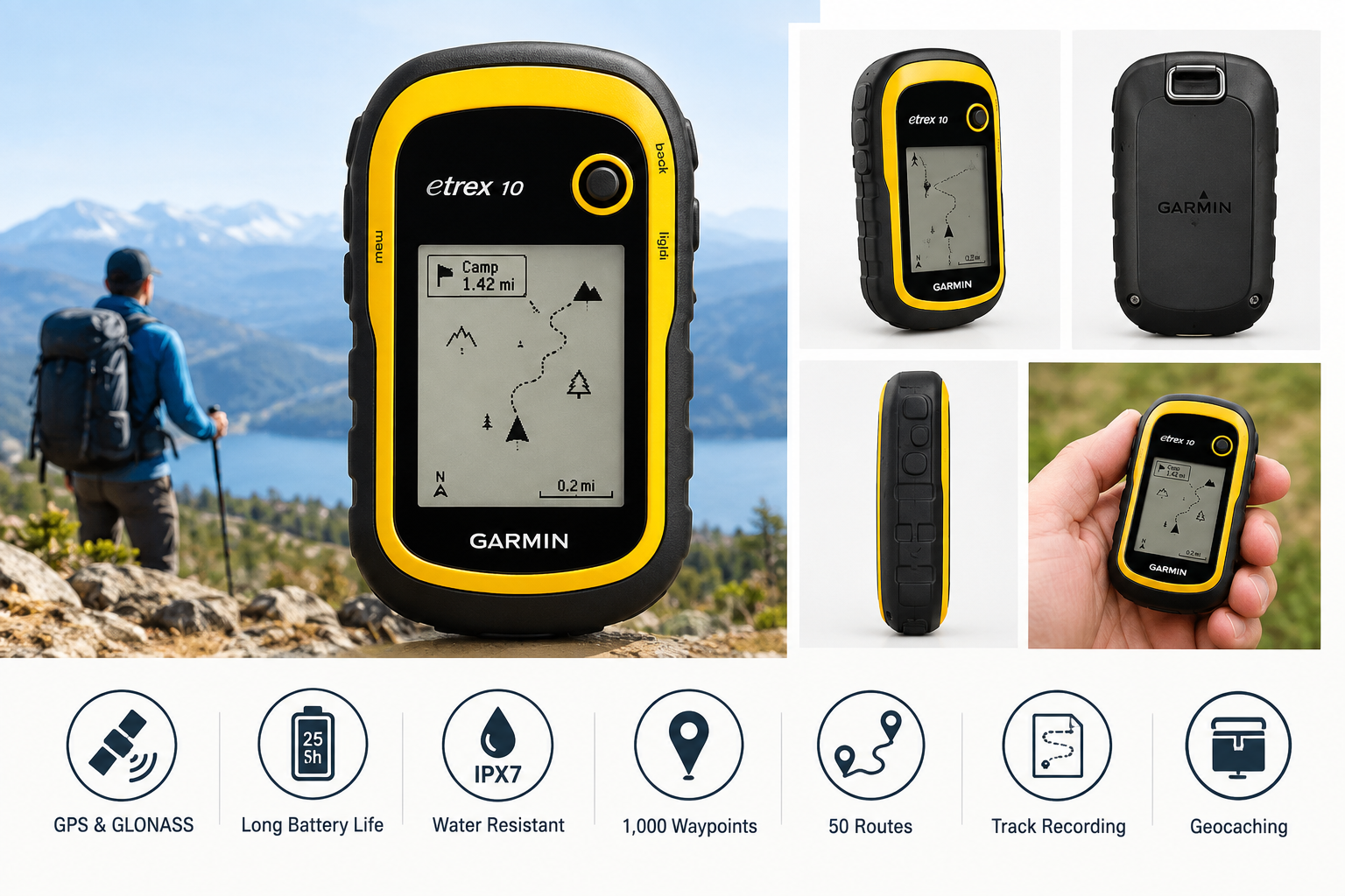
The Garmin eTrex 10 is a compact handheld GPS navigator designed for hiking, geocaching, outdoor navigation, and basic waypoint and route tracking. It combines GPS and GLONASS satellite support, a readable 2.2-inch monochrome display, IPX7 water resistance, paperless geocaching features, and up to 25 hours of battery life from two AA batteries. Its main limitations are the basic worldwide basemap, small low-resolution screen, lack of color mapping, and absence of advanced navigation features found on newer handheld GPS devices.
Introduction
The Garmin 010-00970-00 eTrex 10 Worldwide Handheld GPS Navigator is a straightforward outdoor GPS device for users who value durability, long battery life, and simple location tracking over advanced mapping features. Its compact housing is designed for handheld use in changing outdoor conditions, while the monochrome display remains readable in bright environments and low-light situations.
The eTrex 10 supports both GPS and GLONASS satellite systems for positioning and includes a worldwide basemap, waypoint storage, route planning, track recording, and paperless geocaching. Garmin lists the model as discontinued, so availability and ongoing accessory support may vary depending on the seller and region.
Typical Use Cases
Hiking and Trail Navigation
The eTrex 10 is suitable for recording a route, marking trail junctions, saving campsites, and navigating toward stored waypoints. It can provide useful directional guidance without relying on cellular service.
Geocaching
Paperless geocaching support allows users to store and view essential cache information, including coordinates and descriptions. This makes the device practical for basic geocaching trips without carrying printed notes.
Backcountry Waypoint Management
The device can store up to 1,000 waypoints, up to 50 routes, and extensive track-log information. These capabilities are useful for marking access points, water sources, trailheads, hunting areas, and other locations that may need to be revisited.
Travel and General Outdoor Use
Its worldwide basemap and compact design can assist with basic orientation during travel or outdoor activities. However, it is better suited to coordinate-based navigation than to detailed street navigation or turn-by-turn driving directions.
Performance in Each Scenario
Hiking and Trail Navigation Performance
The eTrex 10 performs well for basic trail navigation. Its high-sensitivity receiver and GPS/GLONASS compatibility help it acquire a position in a variety of outdoor environments. The monochrome transflective display is easy to read in strong daylight and consumes less power than a large color screen.
The main constraint is the limited basemap. The device does not provide the detailed topographic or street-level cartography available on more advanced GPS units. Users who need terrain contours, extensive trail databases, or visual route planning may need to prepare routes in compatible software before a trip.
Geocaching Performance
The eTrex 10 is well matched to entry-level and intermediate geocaching. Paperless functionality reduces the need to carry printed cache details, and waypoint storage makes it easy to organize locations. The directional interface is functional, although the small monochrome screen provides less visual context than a modern color display.
Waypoint and Track Recording Performance
Waypoint marking and track recording are among the device's strongest functions. The eTrex 10 can save routes and tracks for later review or retracing, making it useful for outdoor professionals, hikers, and recreational users who want a record of their movement.
Data can be managed through a USB connection and Garmin's compatible trip-planning tools. The process is more computer-oriented than app-oriented, which may appeal to users who prefer a traditional standalone navigation workflow.
Wet-Weather and Extended-Trip Performance
The IPX7 water-resistance rating helps protect the device from rain and brief water exposure. Its use of two replaceable AA batteries is convenient for extended trips because spare batteries are easy to carry and replace in the field.
Garmin rates battery life at up to 25 hours under suitable conditions. Actual runtime can vary with battery type, temperature, backlight use, satellite conditions, and operating settings.
Strengths Across Scenarios
- Reliable standalone navigation: The eTrex 10 does not require cellular coverage or a smartphone connection for core GPS positioning.
- GPS and GLONASS support: Using multiple satellite systems can help with position acquisition and outdoor tracking.
- Long battery life: Up to 25 hours of operation provides useful endurance for day hikes and multi-day trips with spare AA batteries.
- Rugged, weather-resistant design: The IPX7 rating and compact housing make it suitable for routine outdoor use.
- Readable monochrome screen: The display is designed for visibility in varied lighting and helps conserve battery power.
- Paperless geocaching: Users can store and access relevant geocaching information directly on the device.
- Large waypoint capacity: Up to 1,000 saved locations support organized trip planning and repeated outdoor use.
- Simple controls: The interface is less complex than advanced mapping units, which can benefit users who prefer basic navigation tools.
Limitations Across Scenarios
- Basic mapping: The worldwide basemap provides limited geographic detail and is not a replacement for dedicated topographic or road maps.
- No color display: The monochrome screen is practical but less informative for interpreting complex routes, terrain, and map layers.
- Small display area: The 2.2-inch screen can require frequent zooming or scrolling when reviewing routes and waypoints.
- Limited modern connectivity: The device lacks the smartphone integration, wireless synchronization, and app ecosystem found on newer GPS products.
- Not designed for advanced road navigation: It is primarily a coordinate, waypoint, and track-navigation tool rather than a full turn-by-turn automotive navigator.
- No advanced sensors: Users seeking a built-in electronic compass, barometric altimeter, or sophisticated environmental data will need a more advanced model.
- Older product platform: Because the eTrex 10 is discontinued, future software updates, accessories, and manufacturer support may be more limited than with current Garmin devices.
Verdict
The Garmin eTrex 10 remains a capable basic handheld GPS navigator for hiking, geocaching, waypoint marking, and track recording. Its strongest qualities are its durable outdoor design, replaceable AA batteries, long operating time, simple controls, and dependable core navigation functions.
It is best suited to users who want a dedicated GPS device for coordinates and route tracking without needing detailed maps or smartphone-style features. The limited basemap, monochrome display, and older connectivity make it less appropriate for users who expect advanced topographic navigation, color mapping, or modern wireless integration. For straightforward outdoor positioning and geocaching, however, the eTrex 10 offers a practical and easy-to-understand feature set.